ORBITS OF SATELLITES
T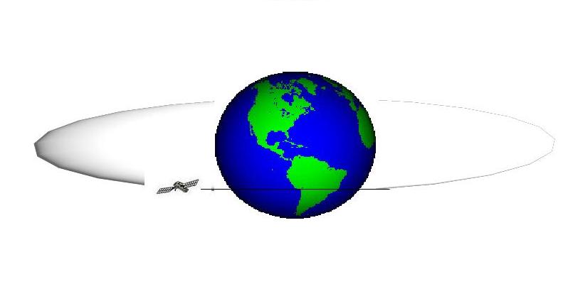 he
orbits of artificial satellites can be distinguished in:
he
orbits of artificial satellites can be distinguished in:
ORBITS OF SATELLITES
The
orbits of artificial satellites can be distinguished in:
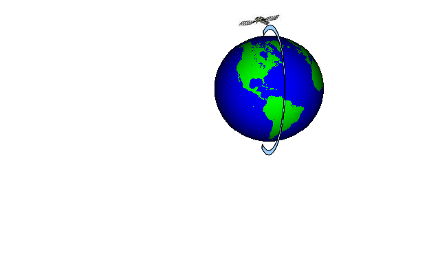
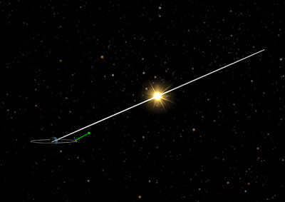
It is an almost circular orbit around the Earth and it is equatorial. This means that the plane of the orbit has no inclination with respect to the equatorial plane. The satellite is positioned at a distance from the equator of around 36,000Km and the time it takes to make a complete revolution around the Earth is 24 hours, which is equal to the time of the Earth's rotation around its axis.
If a satellite has a geostationary orbit, an observer on the Earth, looking towards the sky, will see the satellite stationary. The satellite looks at the same portion of the Earth's surface. The geostationary orbit is typical of the telecommunication and meteorological satellites. A satellite with this type of high orbit (approximately 36,000Km from the Earth) does not provide good spatial resolution, that is, however, not required for observations of the cloud system on the continents.
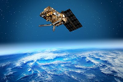
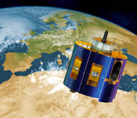 Meteosat
Second Generation..........Credits. ESA- D.Ducros 2002
Meteosat
Second Generation..........Credits. ESA- D.Ducros 2002
Three geostationary satellites, shifted by 120° from each other, along the geostationary orbit, cover the entire globe, except the polar areas, and make possible the global satellite telecommunications.
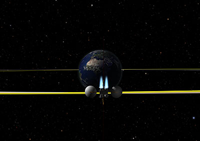
However, it should be noted that a satellite in geostationary orbit is affected by several perturbations. The main perturbations are due to the gravitational pull of the Sun and the Moon, to the fact that the Earth has not a shape of a spherical ball and to the solar radiation pressure. These perturbations alter the position of the satellite over time. For this reason a control program is needed to position the satellite. The maximum permitted tolerances for the displacement in longitude, latitude and elevation of the satellite are defined, to its reference position. The whole of these tolerances define a portion of space in which the satellite is bound to remain; this volume is said Station Keeping Box. The aim of the Station Keeping is to compensate for the effects of perturbations on the position of the satellite. Therefore, periodic orbit corrections are made to keep the satellite into the maximum permitted limits. These operations involve the activation of the thrusters of the satellite.
Solar radiation pressure - Credits: ESA.................................................................................................................................Station keeping for a GEO satellite - Credits: ESA
![]()
The Satellites dedicated to Earth and atmosphere observations follow a polar or near - polar elliptical orbit, so that they are able to fly over regions at all latitudes and can provide images at high spatial resolution of specific areas.
While the polar orbit has an inclination of 90 degrees with respect to the equator, the near-polar sun – synchronous orbit has an inclination from 95 to 100 degrees to the equatorial plane and its altitude is between 600 and 800Km, with a period from 90 to 100 minutes. In this case we say that the satellites follow a low Earth orbit.
Satellites in such orbits will complete 14 orbits around the Earth in a day (if one orbit is done in 100 minutes) and, due to the low Earth orbit, they will move at a very high speed, in order to balance the Earth's gravitational attraction.
These satellites are affected by the braking action of the atmosphere, due to their rather low Earth orbit; then, they are equipped with special motors and automatic stabilization systems to avoid changes in speed.
The orbital plane of a satellite in near-polar sun – synchronous orbit must be at a constant angle with respect to the light coming from the Sun. Therefore, the solar illumination of the Earth's surface must be the same for each revolution of the satellite, around the Earth. Only in this conditions of light, images can be compared.
A satellite in polar orbit is able to scan the Earth's surface in a few days.
It is said that meteorological data come from satellites in geostationary orbits, but starting with the MetOp program - a series of three satellites - the meteorological data are provided by satellites in polar orbits. The data are dedicated not only to improve weather forecasting, but also to monitor climate until at least 2020.
 For
further information about the Meteorological
Operational satellite program please
visit the ESA website starting from the web page:
For
further information about the Meteorological
Operational satellite program please
visit the ESA website starting from the web page:
MetOp........Credits: ESA/AOES Medialab